Understanding GPR Utility Surveys
Ground Penetrating Radar (GPR) utility surveys are an essential tool for modern construction and infrastructure projects. Their ability to detect and locate underground utilities without disrupting the surface makes them invaluable in urban settings, where hidden infrastructure can pose significant risks. In London, where construction activities are abundant and often complex, employing a GPR Utility Survey London is not just a safety precaution but a necessary step for successful project execution.
What is a GPR Utility Survey?
A GPR utility survey is a non-invasive geophysical method that employs radar pulses to image the subsurface and detect underground utilities, including pipes, cables, and voids. This technique utilises high-frequency electromagnetic waves that penetrate the ground, reflecting back to a receiver when they encounter materials of different densities. The resulting data is processed to create detailed images of the subsurface environment, which can help surveyors identify the precise locations and depths of buried utilities.
Key Benefits of GPR Technology
- Non-destructive: Unlike traditional excavation methods, GPR does not disturb the ground, reducing the risk of damaging existing utilities.
- High-resolution results: GPR provides detailed subsurface images, allowing for precise measurements and accurate mapping of utilities.
- Rapid data collection: Surveys can be completed quickly, enabling timely decision-making in project planning and execution.
- Cost-effective: By preventing accidental utility strikes, GPR can save money on potential repair costs and project delays.
Comparing GPR with Traditional Survey Methods
Traditional utility survey methods often rely on manual locating techniques or electromagnetic methods that may not detect all types of utilities, especially those that are non-metallic. In contrast, GPR can locate both metallic and non-metallic utilities, making it a versatile option in mixed urban environments. GPR also bypasses the limitations of visual inspections or trial excavations, providing comprehensive subsurface data without invasive measures.
Stages of Conducting a GPR Utility Survey
Pre-Survey Planning and Preparation
Effective GPR surveys begin long before the equipment is set up. A thorough planning phase is crucial and involves the following steps:
- Site Assessment: Understanding the site conditions, including the types of materials expected underground, potential risks, and previous utility records.
- Stakeholder Consultation: Collaborating with project stakeholders to identify specific survey needs and existing concerns.
- Equipment Selection: Choosing the appropriate GPR equipment based on survey requirements, site conditions, and the types of utilities expected.
Execution of the GPR Survey
Once planning is complete, the survey can be executed. This involves:
- Field Setup: Setting up the GPR equipment with proper calibration to ensure accurate data collection.
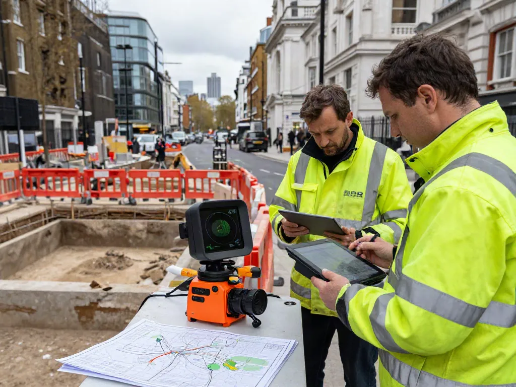
- Data Collection: Conducting the survey by systematically moving the GPR unit across the survey area, capturing radar reflections from subsurface structures.
- Quality Control: Continuously monitoring data during the survey to ensure quality, making adjustments as necessary.
Post-Survey Analysis and Reporting
After data collection, the analysis phase begins:
- Data Processing: Using specialised software to convert raw data into interpretable images and reports.
- Report Generation: Creating comprehensive reports that include detailed maps, depth profiles, and customised recommendations based on findings.
- Stakeholder Review: Presenting results to stakeholders and discussing implications for project planning and execution.
Common Challenges in GPR Surveys
Dealing with Urban Interference
Urban environments often present unique challenges for GPR surveys, including interference from nearby structures and existing utilities. Signal attenuation can occur due to dense materials, which may obscure the radar signals. To mitigate this, operators must carefully select survey frequencies and techniques that suit specific site conditions.
Equipment Limitations and Solutions
While GPR is highly effective, it does have limitations, such as depth penetration constraints and sensitivity to soil moisture content. Ensuring that the survey parameters align with the site conditions can help overcome these challenges. Operators may also use complementary technologies, such as electromagnetic surveys, to enhance data reliability.
Misinformation and Myths about GPR Surveys
There are several myths surrounding GPR, including misconceptions about its reliability or assumptions that it can replace all other utility detection methods. Understanding the capabilities and limitations of GPR is vital for setting realistic expectations and achieving successful survey outcomes.
Best Practices for Successful GPR Utility Surveys
Expert Recommendations for Survey Execution
To maximise the effectiveness of GPR surveys, experts recommend:
- Proper Training: Ensuring personnel are well-trained in both the technology and the interpretation of data.
- Utilising Quality Equipment: Investing in high-quality GPR systems that offer advanced features for data collection and analysis.
- Conducting Preliminary Research: Reviewing historical utility records and existing infrastructure maps before the survey.
Ensuring Compliance with Industry Standards
Adhering to industry standards, such as the PAS128 specifications for underground utility detection, is crucial for ensuring that surveys are conducted to a high quality and safety standard. These benchmarks provide a framework for best practices in utility mapping and reporting.
Continuous Training and Skill Development
The technology surrounding GPR is constantly evolving. Continuous training and development programs for surveyors can help maintain high-quality standards and embrace new methodologies as they become available.
Future Trends in GPR Utility Surveying
Emerging Technologies in Utility Detection
The future of GPR utility surveying looks promising, with several emerging technologies enhancing traditional methods. These include improved sensor technology, drone integration for expansive area coverage, and advanced imaging algorithms that improve data interpretation accuracy.
Predictions for the Industry in 2026
As urbanisation continues to rise, the demand for efficient utility detection methods will also increase. By 2026, GPR technology is expected to become more affordable and accessible, resulting in wider adoption across various sectors, including construction, civil engineering, and environmental assessments.
The Role of AI and Machine Learning in GPR Surveys
Artificial intelligence and machine learning are set to play a transformative role in GPR surveying. These technologies can enhance data interpretation by recognising patterns and improving the speed and accuracy of analysis. Integrating AI will enable surveyors to generate insights from complex data sets, optimising decision-making processes.
How much does a GPR survey cost?
The cost of a GPR survey can vary based on several factors, including site accessibility, the size of the area being surveyed, and the complexity of the subsurface conditions. Typically, the costs range from £1,000 to £5,000 for smaller urban surveys, but can be higher for more extensive projects.
What factors influence the price of GPR utility surveys?
Key factors influencing GPR survey costs include:
- Size and scope of the survey
- Location and accessibility of the site
- Equipment and technology used
- Data processing and reporting requirements
How is GPR technology evolving in utility surveys?
GPR technology is evolving through advancements in hardware and software, enhancing data accuracy and processing efficiency. The integration of real-time data analysis and improved imaging capabilities will continue to push the boundaries of what is achievable in utility detection.
Why should construction firms invest in GPR technology?
Investing in GPR technology allows construction firms to minimise risks associated with underground utilities, reduce project delays, and cut down on unnecessary costs related to utility strikes. By implementing GPR surveys, firms can enhance their operational efficiency and uphold safety standards.
What are the safety precautions during a GPR survey?
Safety is paramount in GPR surveys. Operators should ensure that:
- All personnel are trained in both GPR technology and safety protocols.
- Appropriate personal protective equipment (PPE) is worn.
- Utility maps and site assessments are reviewed before commencing any survey to understand potential hazards.